Jammu and Kashmir Printable Map Pack
Free printable map pack for Jammu and Kashmir. Includes boundary outlines, blank practice maps, quiz sheet, and answer key.
3-Page A4 Worksheet Pack
Includes Reference Map, Student Quiz Map, and Complete Answer Key in a single print-friendly PDF.
Download 3-Page Worksheet Pack🧭 Explore in Interactive AtlasJammu and Kashmir District Map
Interactive preview for all 22 districts.
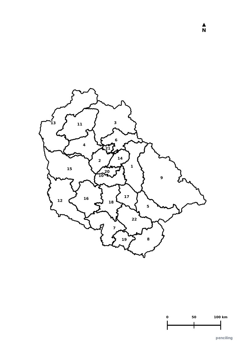
Jammu and Kashmir Practice Test
Students identify each numbered district and write the name in the test blank.
Saffron Capital of India: Pampore is world-famous for cultivating the finest dark-crimson Kashmiri saffron with prized medicinal and culinary aroma.
World’s Highest Railway Bridge: The Chenab Railway Bridge arches 359 meters (1,178 ft) above the riverbed, 35 meters taller than the Eiffel Tower.
Fruit Bowl of the Valley: Kashmir produces over 70% of India’s apples and 90% of its high-grade walnuts in scenic sun-drenched Himalayan valleys.
Famous Shikaras & Houseboats: Srinagar’s carved cedar-wood shikaras and Victorian houseboats on Dal Lake have hosted travelers for generations.
Authentic Kashmiri Pashmina: Spun by hand from the ultra-fine undercoat fleece of high-altitude Changthangi goats grazing in the mountains.
Official State Symbols of Jammu and Kashmir
Official flora, fauna, and natural emblems designated to celebrate Jammu and Kashmir’s rich ecological and cultural heritage.
Hangul / Kashmir Stag
ہانگُل / हांगुल (Hangul)
Cervus hanglu hanglu
The only surviving subspecies of Asian red deer, protected inside the scenic mountain river valley of Dachigam National Park.
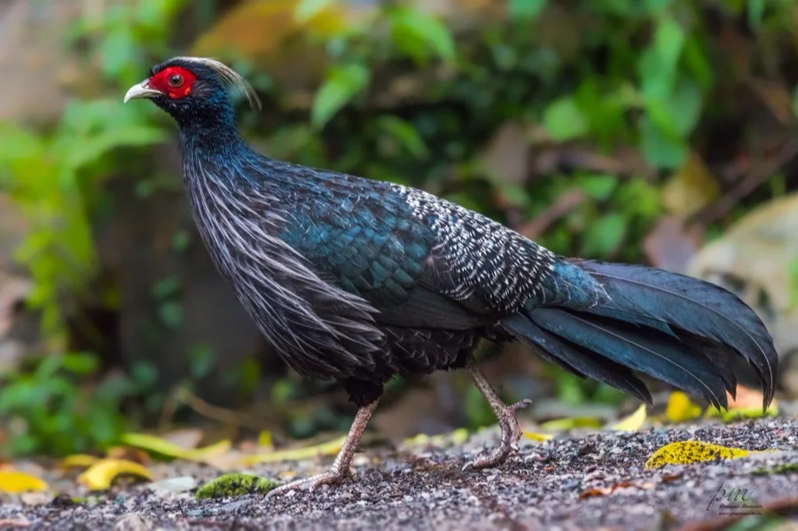
Kalij Pheasant
कलीज तीतर (Kalij Pheasant)
Lophura leucomelanos
A striking glossy blue-black pheasant with a vivid red facial patch and backward-curving crest inhabiting coniferous forests.
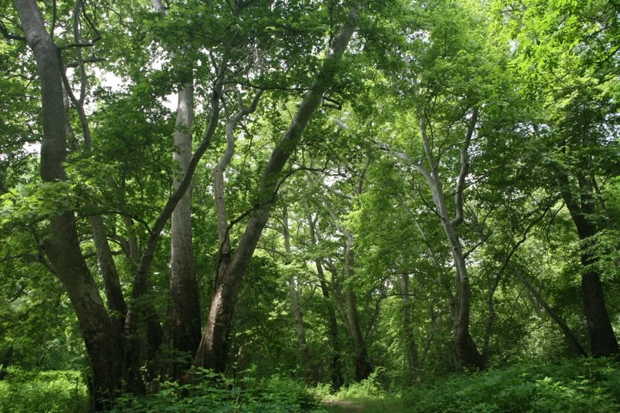
Chinar Tree
چنار / चिनार (Chinar)
Platananus orientalis
Its majestic broad star-shaped leaves turn fiery gold, amber, and red in autumn ('Harud'), celebrated on the shores of Dal Lake.
What's Inside Your 3-Page A4 PDF
Structured print-ready learning system designed for classroom study, practice recall, and self-correction.
Master Reference Map
Full geography outline with every district clearly labelled for visual exploration and classroom study.
Student Quiz Worksheet
Numbered test sheet paired with structured blank answer lines for timed recall, homework, and classroom quizzes.
Complete Answer Key
Alphabetical directory and scoring index for quick self-checking, peer review, and teacher grading.
How to Use This Map Pack in Class or at Home
Complete Answer Key & Index
Alphabetical list of all 22 districts corresponding to the Numbered Quiz Map.
Official & Regional Languages of Jammu and Kashmir
Recognized official, additional official, and prominent regional languages of Jammu and Kashmir. Click any language to explore its Wikipedia article.
Learn to Write in Kashmiri (कॉशुर / کٲشُر)
Generate free custom name tracing sheets, foundational sight words, and alphabet practice in authentic Kashmiri script typography. Built-in school notebook rulings, soft single-shape watermark guides, and instant 300 DPI vector PDF export.
More Northern India India Maps
Explore free printable district maps and practice tests for neighboring states.
Explore All India Educational Maps
Official Cartographic & Boundary Standards
Verified .gov.inAdministrative boundary alignments and regional designations are aligned with official publications by theSurvey of India (National Mapping Agency)and theGovernment of Jammu and Kashmir (jk.gov.in).